 Richmond is a small town in Franklin County, population (as of 2010) is 464.
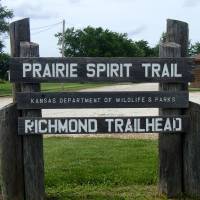
The trailhead for the Prairie Spirit Trail is located in the western edge of town, west of US-59 highway and the old business district, at about mile marker 73.7. Richmond is 6.4 miles south of Princeton, and 2.4 miles north of Scipio Road.
The trailhead offers a nice place to stop for a break, with picnic tables, water, and restrooms.
Directions North and South From Richmond
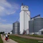
The trail between Princeton and Richmond is wooded on both ends with most of the central section being open prairie. The grade rises slightly towards Richmond. Leaving Princeton, you cross the first bridge on the trail as you head south (Middle Creek). Soon after, the woods give way. and if there is a wind, you will feel it. As you approach the crossing of Missouri Road, you will see a circular house off to the right with a deck all the way around it. Ahead is the distance you will soon spot the Beachner grain elevator. Once the trail becomes shady and surrounded by trees again, you are within a mile of the Richmond Trailhead.
Heading south, you’ll soon pass under Highway 59, the trail canting towards the southeast. The elevation begins to rapidly drop as you make your way towards Scipio Road. As you near the road you will be coming around a small prairie hill to your right. You should be able to see St. Boniface’s church at the top of the hill to your left.
Services along the Prairie Spirit Trail in Richmond
| Photo | Service, Address, Phone | Services |
|---|---|---|
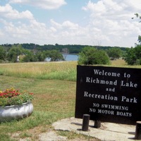 | Richmond City Lake Allen Road (NW 2500 Road), Richmond, KS 66080 785-835-6425 | |
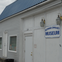 | Richmond Community Museum 119 East Central, Richmond, KS 66080 | |
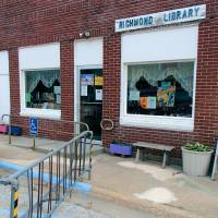 | Richmond Public Library 107 E. Central, Richmond KS 66080 785-835-6163 | |
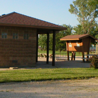 | Richmond Trailhead 200 South Street, Richmond, KS 66080 |
Richmond Photos
Bicycle Touring Through Richmond
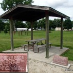
Richmond Shelter
More Information About Richmond